Peak Bagging the Wasatch
- Posted On
- Jul 12, 2016
- Category
- Northern Utah
Destinations
I Have a Confession to Make…..I am a Junkie
By Alisha Niswander
I have a confession to make. I am a junkie. I’m not sure when it happened. Maybe it’s a part of who I am, of who I was meant to be. I’ve always been a bit of a “swim upstream type of girl.” Things progressed. I really took a turn for the worse after college. I moved to Colorado to see what this vision in my head was all about. I got in deep at that point. It was legal and everyone was doing it. Two years later, I decided to move to Park City, Utah for one winter. I was curious if I could shake the habit. That was fifteen years ago. Twelve years ago I decided to fully feed my habit by starting a guiding business. Mountain Vista Touring has not only enabled me to explore new activities and hundreds of miles of trail, it has enabled me to snowshoe, paddleboard, hike, bike and trail run on a daily basis with clients. I not only get my fix, but I am now paid to feed my habit. I am a professional junkie. An outdoor enthusiast, can’t get enough, what’s beyond the next switchback or over the next peak, type of junkie.
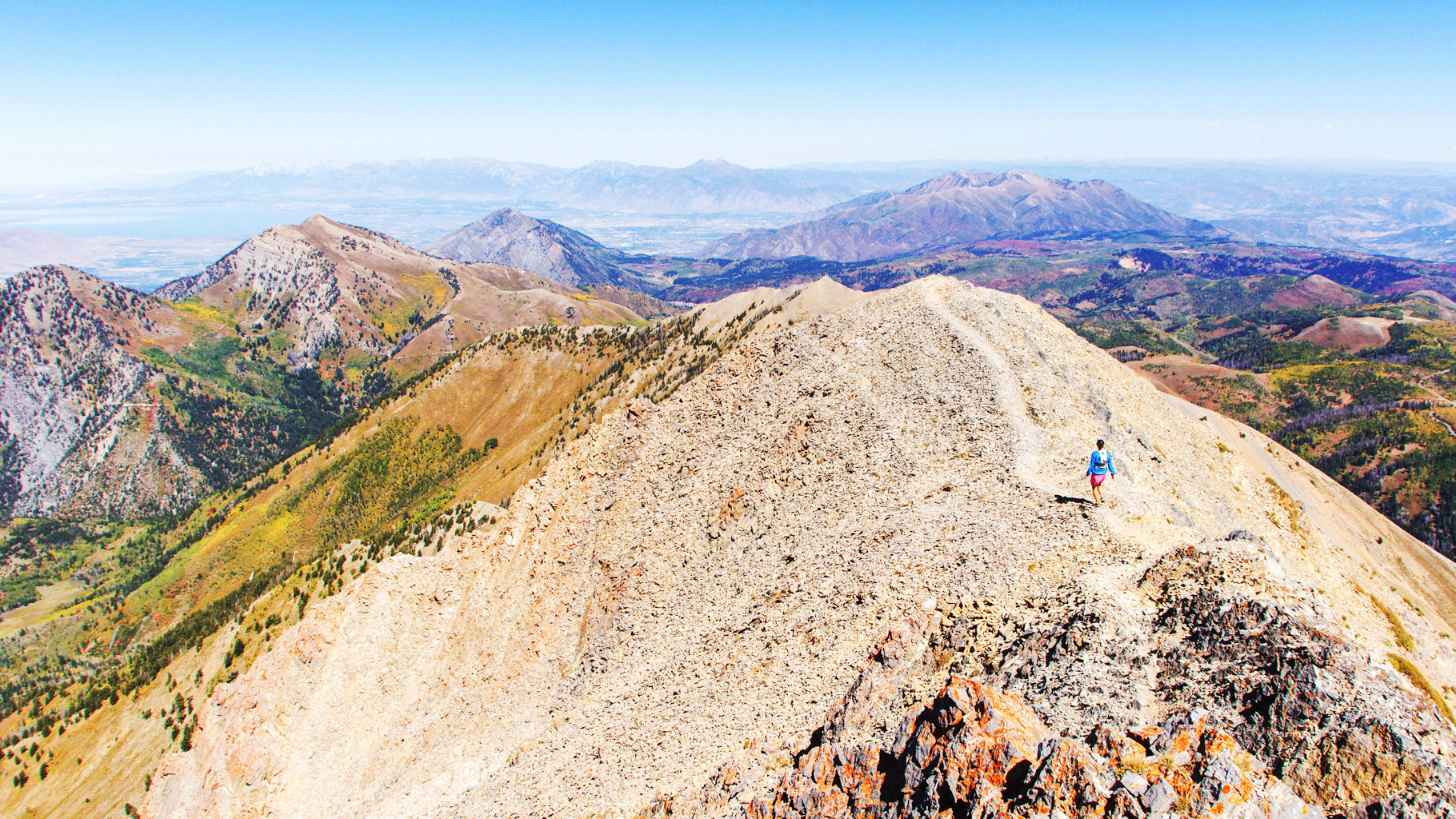
After a series of setbacks this past spring, I realized my hopes of another ultra-marathon were not in the cards for now. So, I decided to take the pressure off myself (for once). This summer I would mix it up. I would venture out of the comfortable, soft, familiar mountains of Park City and head into the unknown. I started going to the Cottonwood Canyons. ‘Life Elevated’ just took on a whole new meaning. I suddenly felt like I was in a different world. There were new challenges, peaks I couldn’t even run up and trails I had to pay attention to because the consequence of falling was all too evident. Again, I was hooked. I started bagging peaks all over the Wasatch Range. At first I didn’t think much of it, it was just what I was doing. Then I realized how invigorating it was, how accessible and how fun!
I started with Grandeur Peak and Mt. Olympus in March and then slowly moved my way south. Gobblers Knob, Mt. Raymond, Superior (classic route and the South Ridge), Pfiefferhorn, Lone Peak, Timpanogos, and finally Mt. Nebo. Having done three of these ten peaks before, I started calling this my ‘Summer of 7 Summits’ of which I will write about.
Some of my favorites are those whose summit lies beyond a hand over hand, watch your footing, type of scramble. The ones where you probably shouldn’t look down. I love the way that my mind calms because literally I can only focus on my next move. It is a peace and a stillness that I haven’t found any other place than in nature, while feeding my habit. It is a place where all those crazy thoughts that threaten my sanity start to dissipate, and finally, finally, everything begins to make sense.
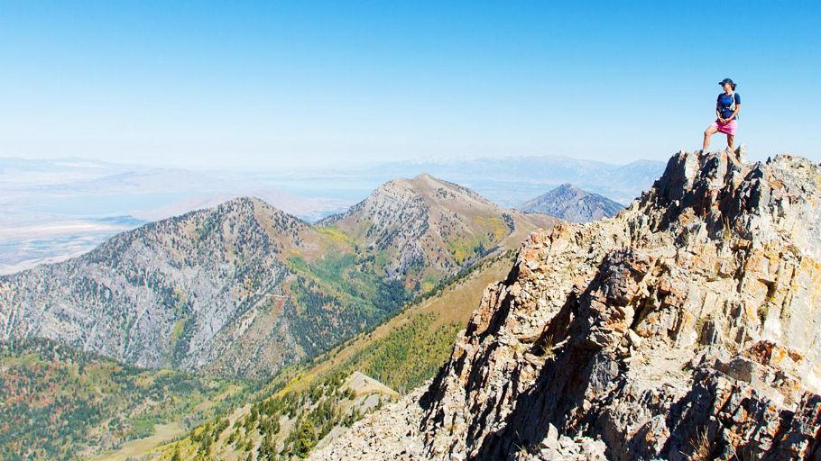
Big Cottonwood provided me with a fun, relatively fast climb up Mt. Raymond (10,241 ft.). This was a very easy trail to figure out. A few miles up, you reach a saddle. Go left and you hit Mt. Raymond, go right and you bag Gobblers Knob (10,246). First time up we went left. Raymond is a step up on the technical side of scrambling and a peninsula outcropping of rock at the top. Here, you look out onto beautiful, pristine, green slopes. There were vibrant yellow and red succulents growing out of the rock everywhere I looked. Green, red and yellow lichen had overtaken every corner of the podium that we were perched on. If you have most of the day, you can definitely bag both Raymond and Gobblers in one shot. We didn’t have the time. So….I came back the next week. I just decided that morning to make the quick 30 minute drive, bag it as fast as I could, run down and head out to the next thing. I ascended pretty quickly. It was one of those days where things were feeling good, weather was perfect and I was in the zone. I stood on the peak for a few minutes, looking northwest into the distance. I saw Mt. Olympus. It was right there. I slowly turned 360 degrees and saw some of the next peaks that would end up making the list that summer. I began to feel the Wasatch and to understand how these peaks could be connected through longer adventures. Snapping back into reality, it was getting hot and I wanted to get out of the sun. I descended to the saddle and then began running down. Again, I was in the zone and feeling good. I was watching about ten feet in front of me so I wouldn’t trip. Then I saw it. I not only saw it, I almost ran into it. It was a badger and he was standing his ground on the trail. Taken off guard, I came to a screeching halt. I knew these critters were surly and scrappy (a little like me). Instinct took over and I did what anyone would do, right? I lunged at it and screamed. Maybe this wasn’t the best idea, but it worked. The badger turned and ran. Screaming and running, I chased him until he disappeared into the bushes. My heart was definitely pounding but I was proud of myself as I continued on down the trail back to my car.
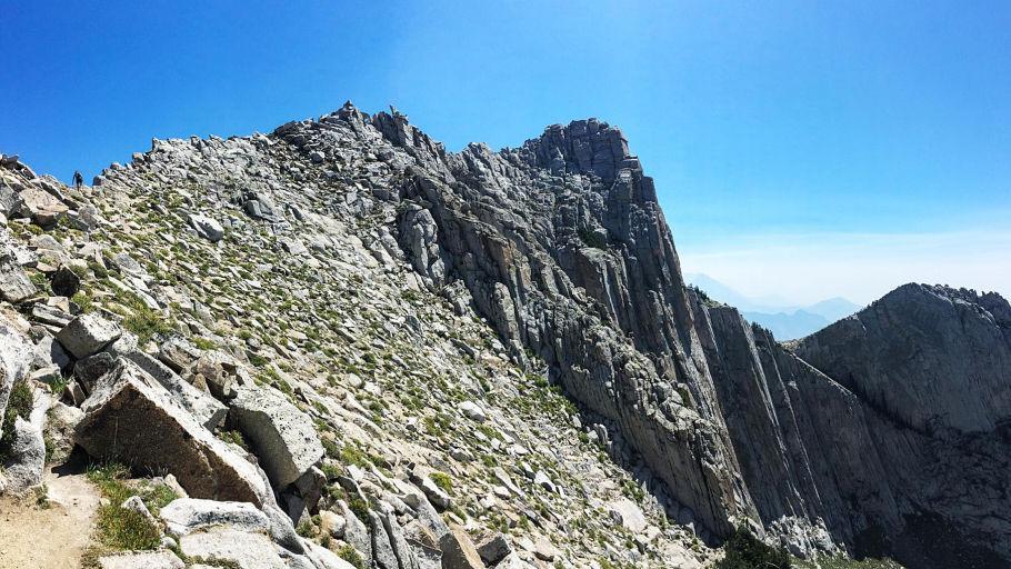
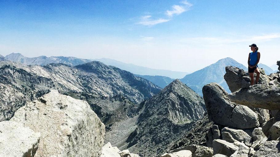
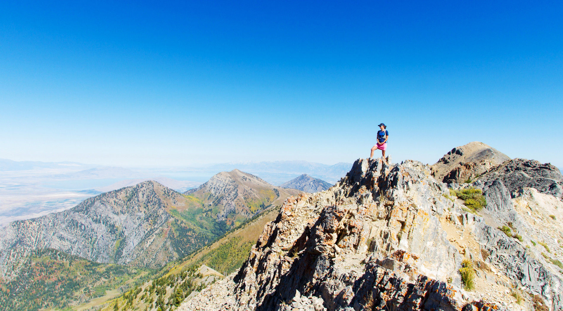
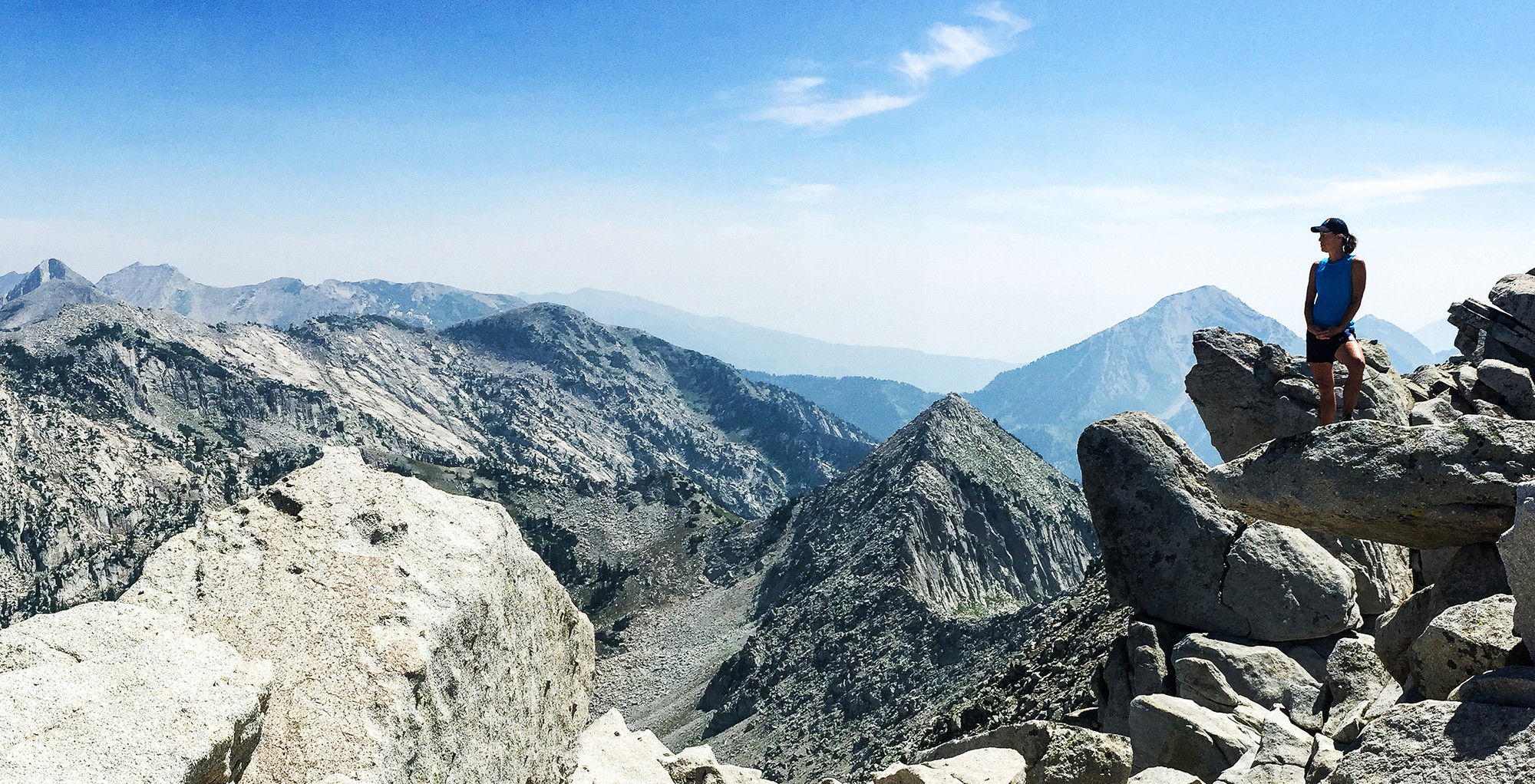
Pfiefferhorn (11,326 ft.) is an iconic peak. It’s a pretty consistent, steep climb up to Red Pine Lake. From there, you pick your way up through the boulders to the ridge line where the scramble begins. The first part is a definite rock hop. You use your whole body to navigate up, over and through the huge boulders that lie between you and the summit. Again, looking down reminds you how significant your foot placement is, how much you need to focus and possibly how insignificant your “problems” have become. Suddenly you find yourself at the base of the peak which now turns into a Neanderthal, all fours type of scramble to the top. At this point, you have earned amazing views, a little break and a celebratory snack.
Mt. Superior (11,132 ft.) is something I attempted to split board last winter. Didn’t make it to the top that windy, gray day so I decided to come back in the summer and bag it. We made it up with no real issues. It’s a moderate ridge line traverse, nothing too sketchy. Something happened on the way down though. My friend and I were in deep conversation about life, relationships and what it all means. All of the sudden we were off trail, in a big way. With nowhere to go but down we ended up descending a pretty steep rock chute, kicking off scree and creating a massive dust cloud in our path. Eventually a bit bloodied and beat up we somehow intersected our trail. The adventures can’t all be flawless right?
The South Ridge of Superior is something else. I had been wanting to do this for a while. One day a girlfriend called up and said let’s go. This climb was the most exhilarating of the whole summer. Scouting and finding the route was one thing. Managing the route was something else. Once you start, there is nowhere to go but up. Literally, there is no turning back. You just keep putting one hand over the other and slowly moving your feet up step by step. It was so technical, so rewarding, and so heart pounding. We came down the classic route which luckily didn't involve a chute this time.
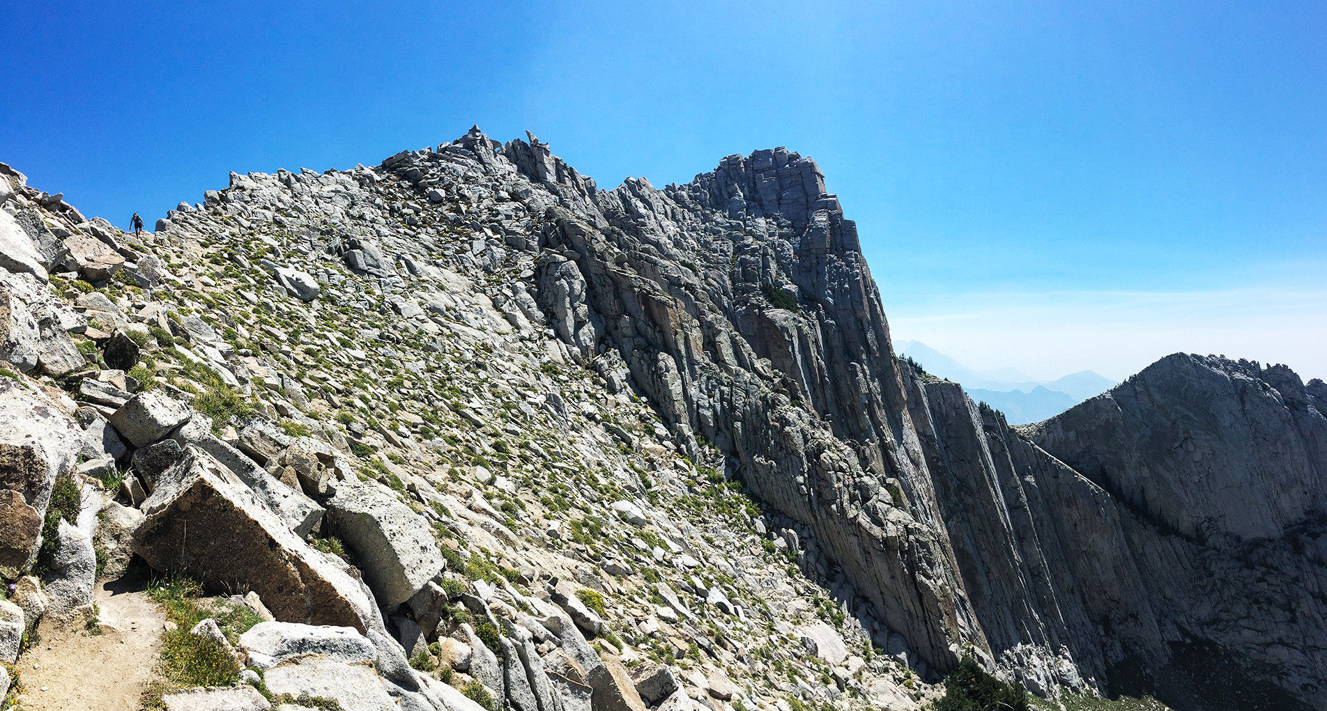
On to Lone Peak (11,253 ft.). I didn’t know much about this peak until I did a brief amount of research. This is my downfall. I look something up on the internet, scribble very vague directions on a scrap of paper and shove it in my pocket. Trail veers left at rock and then back right toward the pine trees and up to the summit (or something like that). Problem is, it all makes sense when I’m reading it online. Giving myself too much credit, I assume I will remember all the little details that I neglect to actually write down. Sometimes, I also underestimate the time it will take by looking at the vertical gain and the miles covered. Oh yeah, no problem, That will take 5 hours or so. Lone Peak was a classic example of this. We approached from Jacob’s Ladder. I liken this to Mt. Olympus, on steroids. It was steep! Long story short, after spending some time in the thick brush on the east side of the cirque when we needed to be on the west side of the cirque, we found the summit. Throughout the final 200 yards or so of Lone Peak, you have to be on your game. This was the narrowest ridgeline I had yet attempted and there was no room for error. Hand over hand, head spinning, adrenaline pumping, we made it. Sweet! Take a pic, have a bite, and let’s go grab a beer. Lone Peak had something different in mind. Again, in deep conversation on the descent, somehow we missed something. That something was the trail. We ended up about 1000 ft. below where we were supposed to be. With water and food waning, it became clear. We were severely turned around. We started navigating our way back uphill which involved walking up granite rock hand over hand, heading to numerous high points to try to get our bearings. Finally, about 3 hours later, we found the trail. I was exhausted, relieved and extremely grateful. My cocky attitude of 5-6 hours took us ten. Lone Peak, I am coming back for revenge this summer.
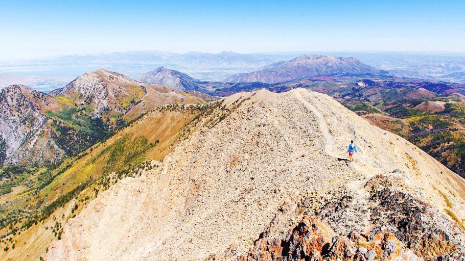
Last but not least, Mt. Nebo (11,929 ft.). After a two hour drive, we arrived at the trailhead of the highest mountain in the Wasatch Range. Here we began a pretty moderate grade ascent. Nebo is not a technical peak. It is remote. You are out there and, chances are, you are alone. It was a warm, beautiful fall day. We climbed and climbed and chatted it up. The summit push gets a little steeper and involves a bit more route finding but nothing too difficult. Looking around at beautiful lush meadows and mountain goats in the distance, you can see for miles and miles. It was unknowingly an all-day event with taking in the views and making the drive but well worth it.
I encourage you to get out and bag something this summer. Whatever that “something” is, just go do it. There are loads of options from beginner to advanced but one commonality is that the views, the accomplishment, the feeling of being on top is worth the walk. Take advantage of the beauty that lies among the Wasatch and the amazing opportunities we have to be in touch with nature. Tune out the world and tune into yourself. You just may learn something.
Alisha Niswander is the owner and lead guide of Mountain Vista Touring. If you need a little adventure encouragement this summer you can find her at ParkCityHiking.com
Editor’s note: The elevations in Alisha Niswander’s article are in feet above sea level. To put her accomplishments into perspective, the Salt Lake International Airport is at 4226 ft. The top of Big Cottonwood Canyon at the base of Brighton Ski Resort is 8730 ft. and the parking lot off Wasatch Boulevard and trailhead at the base of Mt. Olympus is 4800 ft. Do the math.
Archives
- 2023
- 2022
- 2021
- 2020
- 2019
- 2018
- 2017
- 2016
- 2015
- 2014
- 2013
- 2012
- 2011
- 2010